Slide 1

Production, visualization and analysis of large volumes of remote sensing images modeled as multidimensional data cubes for the entire Brazilian territory.

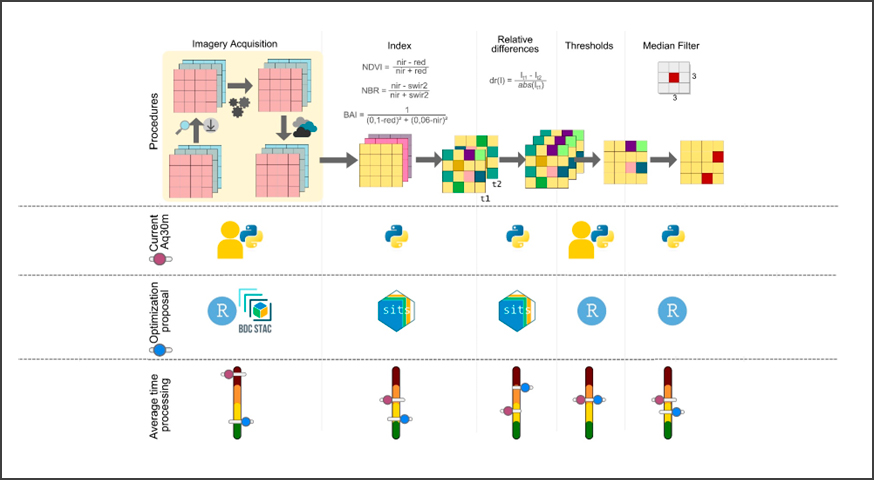
Using Earth Observation Data Cube to Mapping Burned Areas

by Mateus de Souza Macul¹, Wesley Campanharo¹, Fabiano Morelli¹, Gilberto Ribeiro de Queiroz¹, Karine Reis Ferreira¹ 1National Institute for Space Research (INPE), Brazil GeoInfo: http://mtc-m21d.sid.inpe.br/rep/8JMKD3MGP3W34T/488BPNL Publisher: GeoInfo | Published: 29 November 2022 © Author(s) 2022. This work is distributed under the Creative Commons Attribution 4.0 License. Abstract Earth observation data cubes are multidimensional structures created from Analysis-Ready …

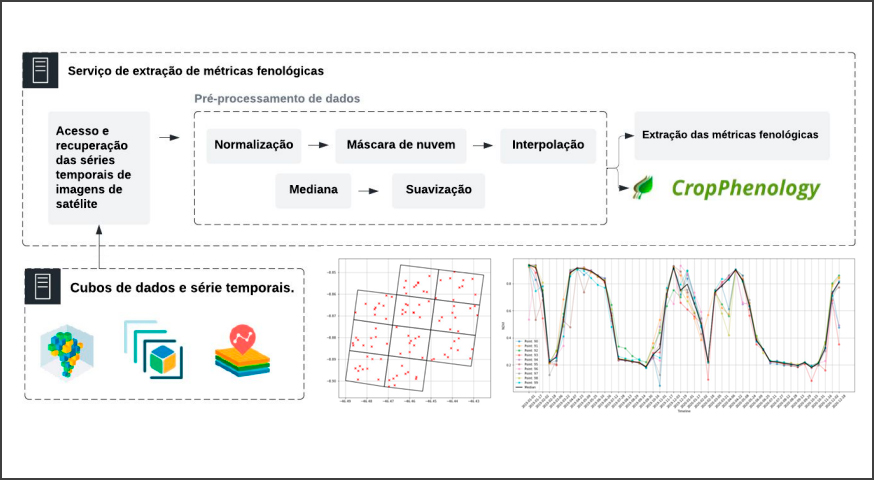
Web Service for extracting Phenological Metrics for Agriculture using time series of satellite images

by Gabriel Kyama Alves¹, Karine R. Ferreira¹, Bruno Schultz, Thiago G. Rodrigues e Luiz F.R. Carvalho 1National Institute for Space Research (INPE), Brazil GeoInfo: http://mtc-m21d.sid.inpe.br/rep/8JMKD3MGP3W34T/488BPNL Publisher: GeoInfo | Published: 29 November 2022 © Author(s) 2022. This work is distributed under the Creative Commons Attribution 4.0 License. Abstract The study of seasonal vegetation patterns observed by remote sensing …

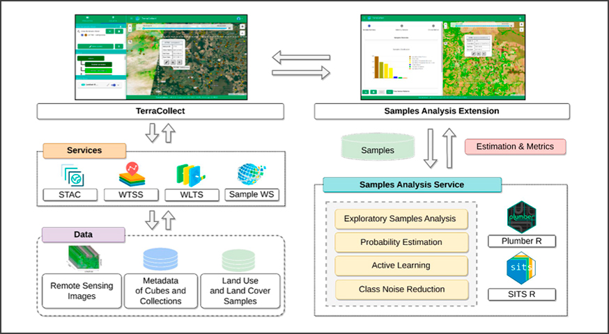
Integranting Analysis Methods During Land Use and Land Cover Sampling

by Abner Ernâni dos Anjos¹, Karine Reis Ferreira¹, Gilberto Ribeiro de Queiroz¹, Fabiana Zioti ¹, Gabriel Sansigolo¹ 1National Institute for Space Research (INPE), Brazil GeoInfo: http://mtc-m21d.sid.inpe.br/rep/8JMKD3MGP3W34T/488BPNL Publisher: GeoInfo | Published: 29 November 2022 © Author(s) 2022. This work is distributed under the Creative Commons Attribution 4.0 License. Abstract The Land Use and Land Cover (LULC) mapping …

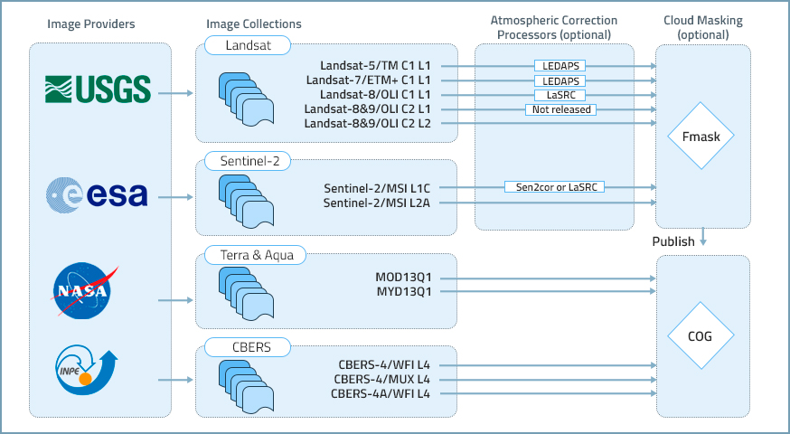
Generating analysis ready data collections for Brazil

by Rennan F. B. Marujo¹, Karine R. Ferreira¹, Gilberto R. Queiroz¹, Raphael W. Costa¹, Jeferson S. Arcanjo¹, Ricardo C. M. Souza¹ National Institute for Space Research (INPE), Avenida dos Astronautas, 1758, Jardim da Granja, Sao Jose dos Campos, SP 12227-010, Brazil DOI: https://doi.org/10.1109/IGARSS46834.2022.9884104 Publisher: IEEE  | 28 September 2022 Abstract Brazil is a country of continental scale area, …

The BDC team provided training on its data and software products this week

This week, from 08/29/2022 to 09/02/2022, the Brazil Data Cube (BDC) team provided training on the project’s data and software products. The training lasted 20 hours, with practical parts using Python and R programming languages through jupyter notebooks in a Kaggle environment and had the participation of 58 researchers and fellows from INPE and some …

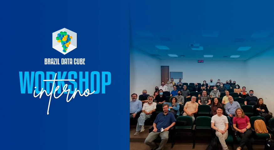
Internal Workshop of the Brazil Data Cube project

Last Friday, July 29, 2022, an internal workshop on the Brazil Data Cube project was held at INPE. The event was attended by 42 people, including the project team, partners, collaborators and master’s and doctoral students. In this workshop, the results, advances and partnerships with other INPE projects were presented and discussed, with the aim …

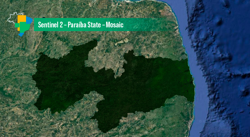
Sentinel 2 – Paraíba State – Mosaic

by BDC Team National Institute for Space Research (INPE), Avenida dos Astronautas, 1758, Jardim da Granja, Sao Jose dos Campos, SP 12227-010, Brasil DOI – https://doi.org/10.52169/UAZM9531 Posted by Inpe | Published: May 2022 Overview An image mosaic of the Sentinel-2 images covering the Paraíba State in Brazil. It was created from a Sentinel-2 data cube, with …

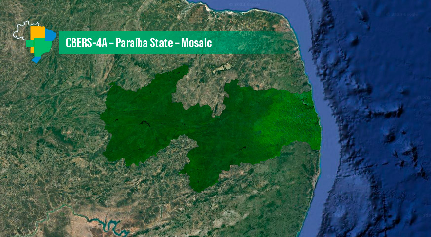
CBERS-4A – Paraíba State – Mosaic

by BDC Team National Institute for Space Research (INPE), Avenida dos Astronautas, 1758, Jardim da Granja, Sao Jose dos Campos, SP 12227-010, Brasil DOI – https://doi.org/10.52169/LTCE9643 Posted by Inpe | Published: May 2022 Overview An image mosaic of the CBERS-4A images covering the Paraíba State in Brazil. It was created from a CBERS-4A data cube, with …

Brazil Data Cube - 2019 - 2024