
Automated cloud coverage analysis with Brazil Data Cube
by Thainara Lima¹, Rômulo Marques ¹, Ueslei Sutil¹, Cláudia Almeida¹, Claudio Barbosa¹, Thales Körting¹, Gilberto Queiroz¹
¹Instituto Nacional de Pesquisas Espaciais Avenida dos Astronautas, Jardim da Granja,
São José dos Campos, SP, Brazil, CEP 12227010
Publisher: Anais do 22º GEOINFO | Published: 2 December 2021
Abstract
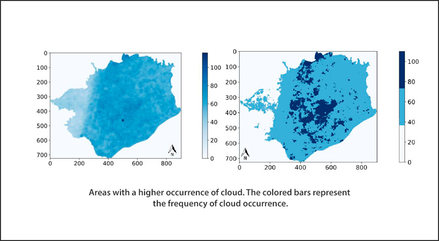
This paper approaches the topic of Data Cubes applied to the management and monitoring of the brazilian land surface. It presents the results of an instrumental work that aimed at developing a tool in Python language, capable of processing raster and vector data from cloud masks of the Brazil Data Cube STAC catalog, with the purpose of generating statistical assessments of the cloud coverage of a given place in a given period of time. The program was developed in the Jupyter Notebook environment, and hence, it is an opensource software development
Keywords:
© This is an open access article distributed under the Creative Commons Attribution License which permits unrestricted use, distribution, and reproduction in any medium, provided the original work is properly cited