
BDC team attended the XXIV ISPRS Congress 2022 last week presenting three papers
The BDC team attended the International Society for Photogrammetry and Remote Sensing Congress (XXIV ISPRS 2022), presenting three papers.
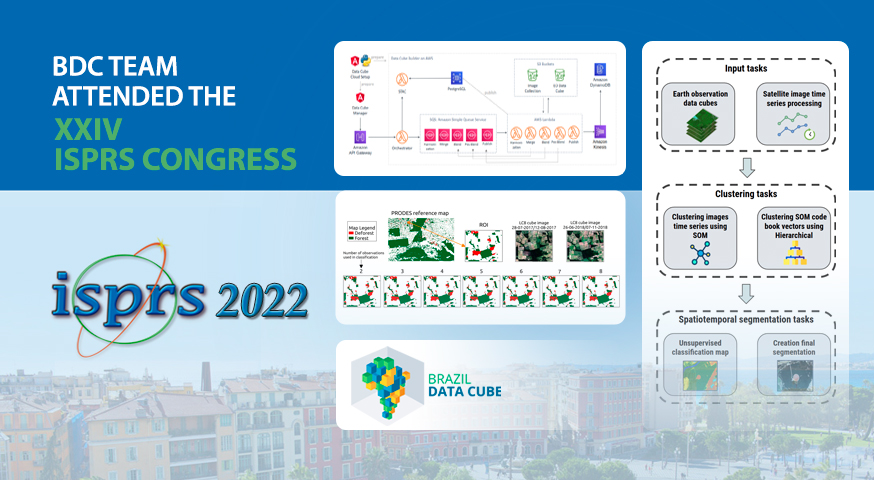
The first paper “Building Earth Observation Data Cubes on AWS” describes an application for building EO data cubes on the Amazon Web Service (AWS) cloud computing environment.
The second paper “Spatiotemporal Segmentation of Satellite Image Time Series Using Self-Organizing Map” presents a methodology for spatiotemporal segmentation of satellite image time series.
The third paper “An Analysis of the Influence of the Number of Observations in A Random Forest Time Series Classification to Map the Forest and Deforestation in the Brazilian Amazon” presents a study to determine the effects on the accuracy of the data analysis of varying the number of satellite observations, using a Random Forest classification algorithm.
The papers are also available on the publications page of the project’s website and the presentations will be available at Brazil Data Cube Channel on Youtube later this week.
Source: Brazil Data Cube Team.


