
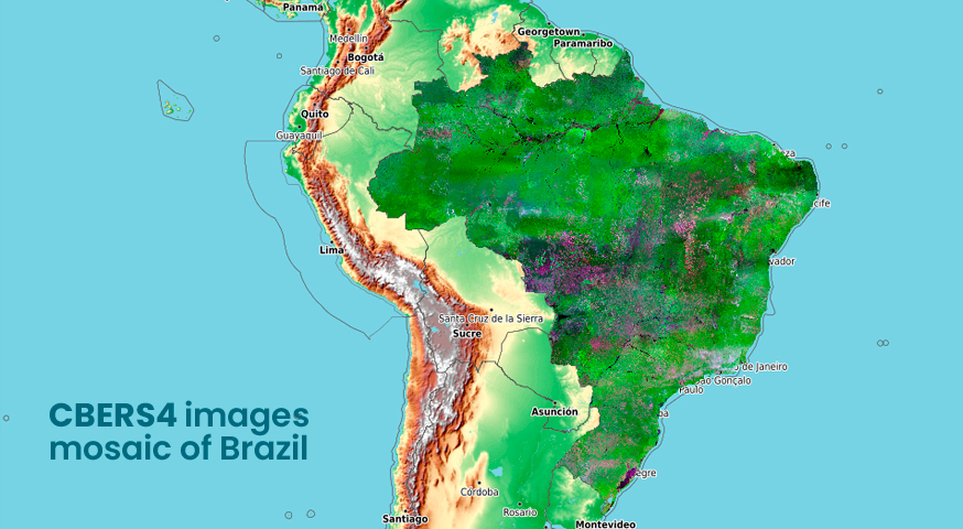
CBERS4 images mosaic of Brazil by the Brazil Data Cube Project
A CBERS4 image mosaic of Brazil was launched today by the Brazil Data Cube project team.
This mosaic uses CBERS4/WFI images, surface reflectance, with 64 meters of spatial resolution.
It was generated with technologies under development in the Brazil Data Cube project, using the best pixel (free from cloud and cloud shadows) chosen in a three-month period (April, May and June 2020).
The product uses a RGB composit with red(B15) , NIR(B16) and blue(B13) bands.
In addition to the mosaic with a resolution of 64 meters, we also offer two other versions, with 128 and 250 meters, respectively. These mosaics can be downloaded in GeoTIFF format from the following links:
- 64m Mosaic (original resolution) – 6.1 GB;
- 128m Mosaic – 1.9 GB;
- 250m Mosaic – 511 MB.
It is also possible to access this mosaic in GIS applications through the OGC WMS service, using the following address:
- http://brazildatacube.dpi.inpe.br/bdc/geoserver/bdc_brmosaic/wms
- Choose layer cbers_full_resolution_tiles
Source: Brazil Data Cube Project.