

Quality control and class noise reduction of satellite image time series
by Lorena Alves Santos 1,*,Karine Ferreira 1,Michelle Picoli 1,Gilberto Camara 1, and Rolf E. O. Simoes¹
1Earth Observation and Geoinformatics Division, National Institute for Space Research (INPE), Avenida dos Astronautas, 1758, Jardim da Granja, Sao Jose dos Campos, SP 12227-010, Brazil
DOI: https://doi.org/10.1016/j.isprsjprs.2021.04.014
Publisher: ScienceDirect | Published: 15 May 2021
Abstract
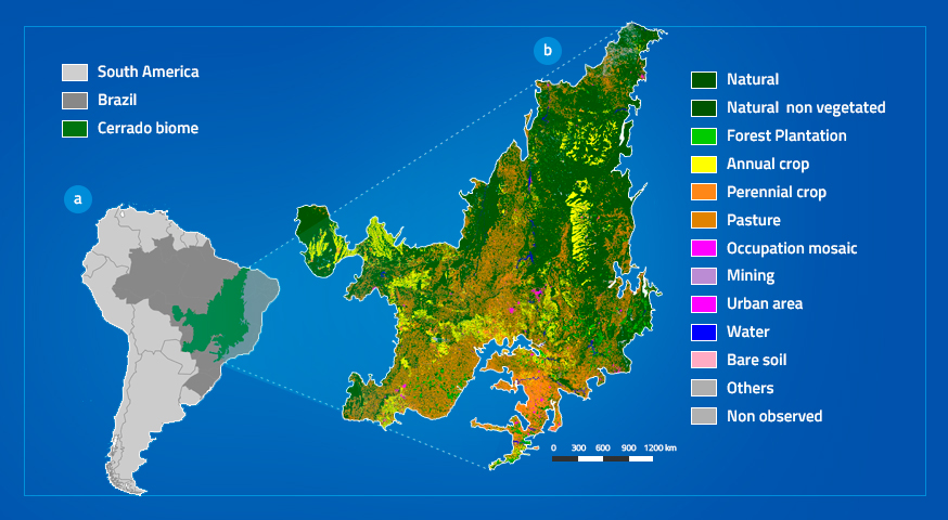
The extensive amount of Earth observation satellite images available brings opportunities and challenges for land mapping in global and regional scales. These large datasets have motivated the use of satellite image time series analysis coupled with machine learning techniques to produce land use and cover class maps. To be successful, these methods need good quality training samples, which are the most important factor for determining the accuracy of the results. For this reason, training samples need methods for quality control of class noise. In this paper, we propose a method to assess and improve the quality of satellite image time series training data. The method uses self-organizing maps (SOM) to produce clusters of time series and Bayesian inference to assess intra-cluster and inter-cluster similarity. Consistent samples of a class will be part of a neighborhood of clusters in the SOM map. Noisy samples will appear as outliers in the SOM. Using Bayesian inference in the SOM neighborhoods, we can infer which samples are noisy. To illustrate the methods, we present a case study in a large training set of land use and cover classes in the Cerrado biome, Brazil. The results prove that the method is efficient to reduce class noise and to assess the spatio-temporal variation of satellite image time series training samples.
Keywords: Self-organizing map; Class noise reduction; Bayesian inference; Satellite image time series; Land use and cover classification
© This is an open access article distributed under the Creative Commons Attribution License which permits unrestricted use, distribution, and reproduction in any medium, provided the original work is properly cited
Share and Cite
Santos, L.A.; Ferreira, K.; Camara, G.; Picoli, M.; Simões, Rolf. E. Quality control and class noise reduction of satellite image time series. ISPRS Journal of Photogrammetry and Remote Sensing. Volume 177, July 2021, Pages 75-88.